Artificial Intelligence for Monitoring of Infrastructure
With AIMI, we are revolutionizing infrastructure monitoring through AI-supported analyses and state-of-the-art aerial technologies. The future of pipeline monitoring: Precise. Efficient. Digital.
AIMI is being developed by OGE and Thyssengas in cooperation.
PROBLEM
Aerial photographs of sources of danger must be documented and processed.
Relevance
Digital line monitoring is becoming increasingly relevant, but faces challenges.
Cost increases
30 % increase in the last two years.
Labor shortage
Fewer staff and higher costs at the same time.
Susceptibility to errors
Human inspections are limited.
Solution
AIMI offers the end-to-end solution.
Unmanned aerial photography
Data is still collected by helicopters or airplanes, but will be covered by unmanned drones in the future with AIMI.
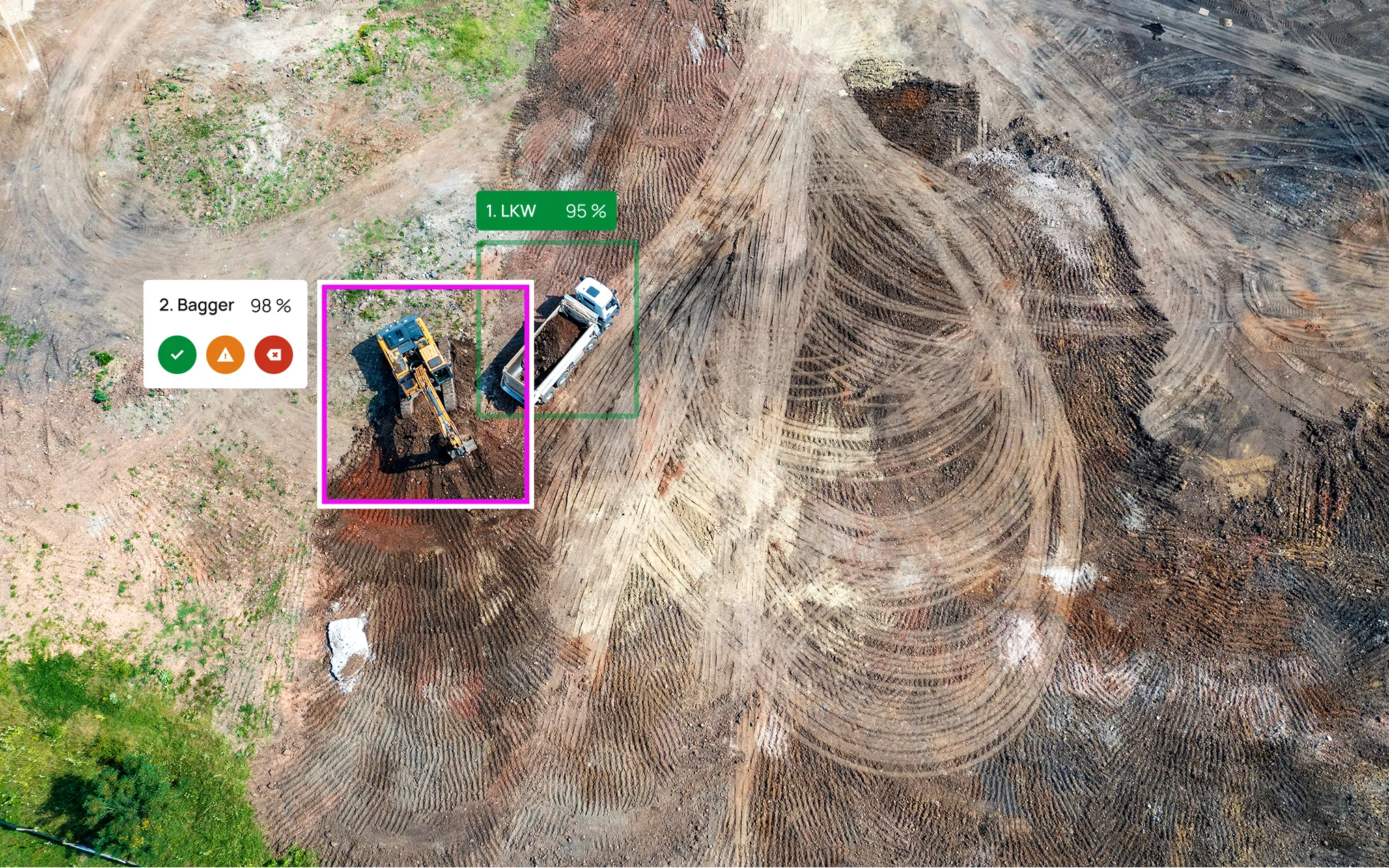
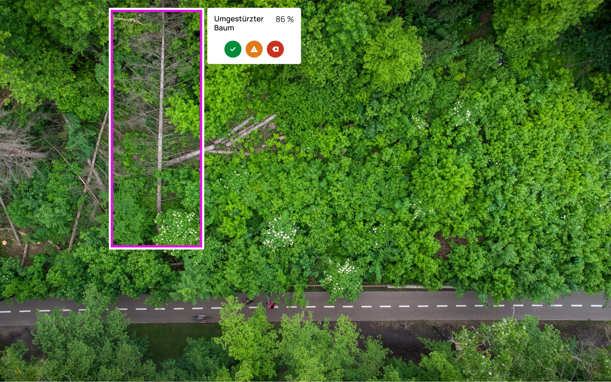
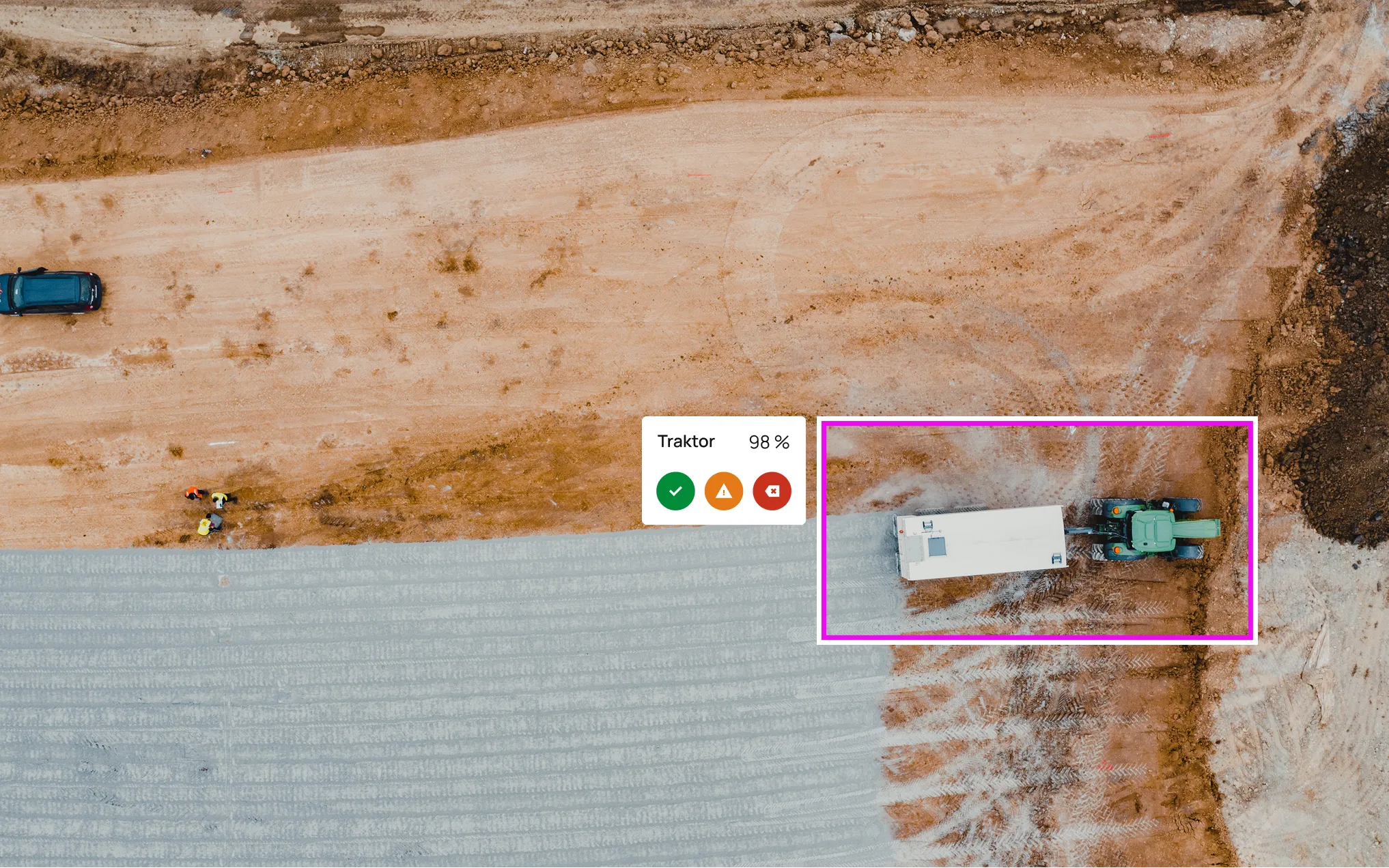
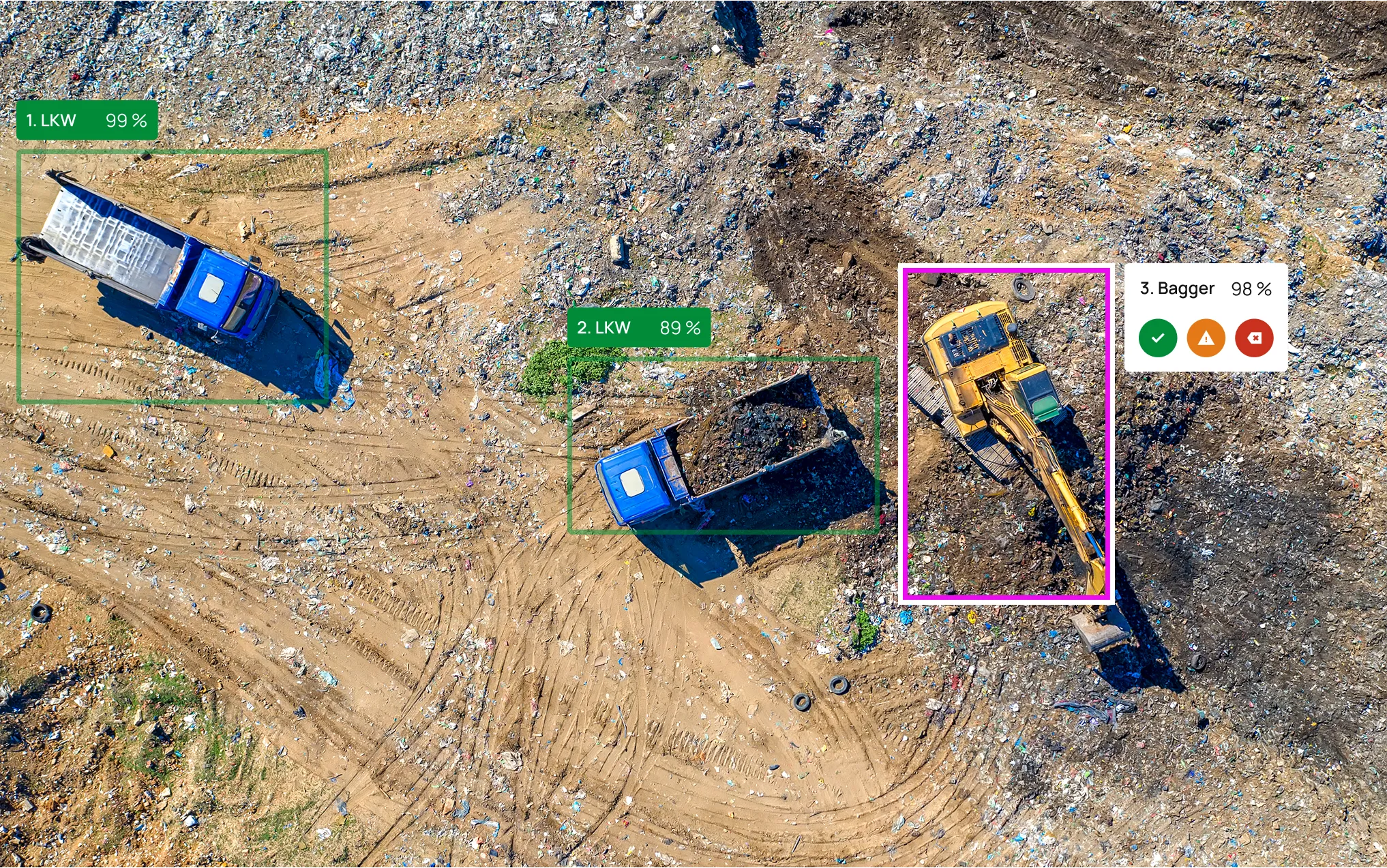
Precise AI analysis
AI-supported detection and classification of sources of danger.
Flexible reporting
Clearly presented results that can be directly integrated into your systems.
Once implemented, secure in the future thanks to our AI-supported software and state-of-the-art technology for optimized line monitoring
Seamless monitoring
Precise risk analysis
Reduced CO₂ emissions
Reduced on-site operations
50 % faster inspections
Reduction of errors
Increased efficiency
Detailed aerial photos
Procedure
Unique interplay of technology and expertise
Planning
Determine flight routes and destinations
Data collection
High-resolution aerial images using the latest technology
Analysis
AI evaluates and reports hazards
Actions
Clear results for efficient follow-up measures
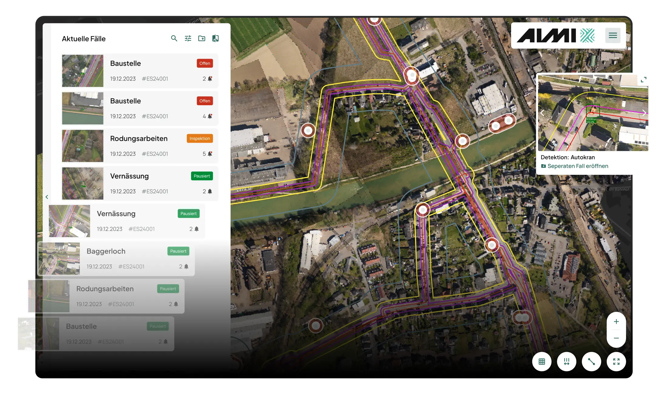
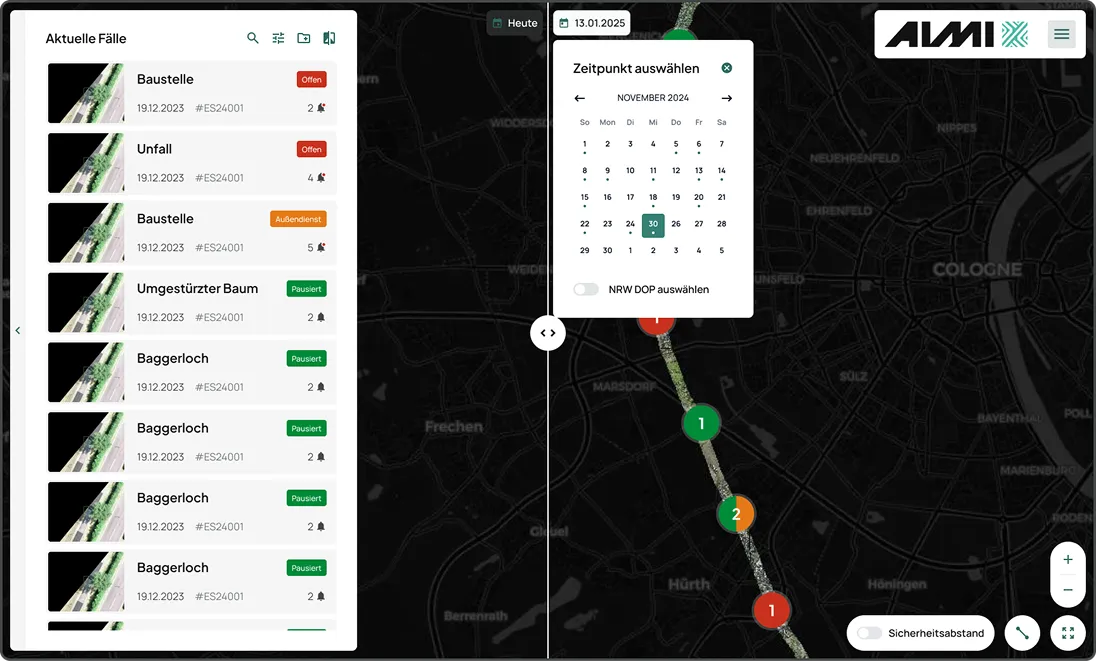
Case processing with detailed reporting history
Maximum control and efficiency - AIMI offers you intelligent & helpful functions
Auswahl und Slider für Vergleichsbefliegungen
Functions
AI-supported localization of sources of danger
Historical history of aerial image data and detections
Clear view of cases and individual detections
Geographical allocation and delineation of regional responsibilities